
David Roberts RA
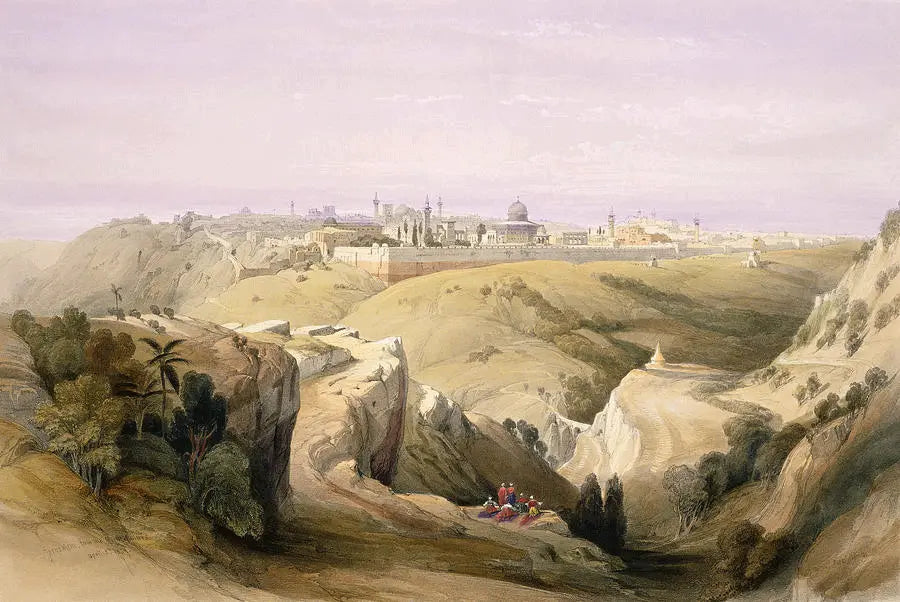
Jerusalem from the Road Leading to Bethany
Subscription edition & first edition lithographs in stock
Full plate: 6
Presented in a acid free mount
Scroll down for full description
Due to the constant change in buying and selling these works, the plates illustrated are examples only. Please ask to see the one you are buying.
Jerusalem lies near the summit of a broad mountain ridge. This ridge, which is everywhere not less than from twenty to twenty-five miles broad, is in fact a high irregular table land. The surface of the elevated promontory on which the city stands sinks somewhat steeply towards the east, terminating in the Valley of Jehoshaphat.
The breadth of the whole site of Jerusalem from the Valley of Hinnom to the Valley of Jehoshaphat is about 1020 yards, or half a geographical mile. The surrounding country is of the limestone formation. The region is dreary, and the soil seems sterile yet the olive thrives, and corn is grown in the levels and valleys. The vine and fig-tree flourish no longer on the hills, but the latter grows in the sheltered spots, and is frequent near Bethlehem. The city is called by the Arabs, El-Kuds (the Holy); and also by Arabian writers, Bek El-Mukaddas (the Sanctuary).
The spectator is presumed to be standing on the Mount of Olives, looking towards the Mosque of Omar, which stands on the central point of the view. On its left is the Mosque El Aksa.
The space within which those edifices stand, is enclosed by a wall of great thickness, formed of stones of remarkable size, some of them thirty feet, and with great probability supposed to have formed part of the original wall of the platform, on which stood the temple built by Herod. This enclosure is the summit of Mount Moriah, on which no Christian or Jew was once permitted to set his foot (though of late years, the prohibition is occasionally relaxed).
Beyond, and rising above it, is Mount Sion, the site of the city of David. Its northern part is now the most dilapidated portion of Jerusalem, and is chiefly inhabited by Jews, in a state of poverty. On the summit are seen the towers of the citadel. To the left is the Armenian convent : still farther to the left, and outside the walls, is the Muslim Tomb of David ; and near it a small Greek Church built on the spot assigned by tradition as the place where the "Last Supper" was solemnized. Farther on the right is Acra, the third hill, on whose ridge stands the Church of the Holy Sepulchre ; the ridge is separated from Zion by the Tyropaon. And still farther to the right, and also within the walls, is the fourth hill, now covered with hovels. The summit commands a fine view of the city and the monks have chosen to assign it as the site of a palace of Herod Agrippa, Its position would certainly accord with the taste and policy of a race, who so strikingly united the pomp of royalty with the vigilance of despotism. Beyond this hill and the walls lies the Tomb of the Kings.
At the foot of the spectator is the Valley of Jehoshaphat, through which flows the brook Kedron. Immediately under the Gate of St. Stephen is a small church traditionally standing over the burial-place of the Virgin Mary. Close to it is the memorable Garden of Gethsemane. To the right of the garden is the Pillar of Absalom, and lower down are the disputed "pools of Siloam."

